
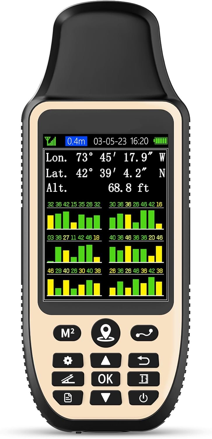
ZL660 Land Surveying Equipment, Handheld GPS for Surveying
$107.09
Related Products




Product description

7 Measurement Modes – Make Your Measurement Easy 

What are the precautions before using this device?
-All measurement methods need to be used outdoors under an uncovered sky and the signal value in the upper left corner of the device screen is below 1 m!
-Recommend to measure area above 0.04 acres and distance above 328 ft
The video showcases the product in use.The video guides you through product setup.The video compares multiple products.The video shows the product being unpacked. Auto-track Area Measurement
Auto-track Area Measurement
You can use this method to measure irregular terrain area, such as mountains, sloping fields, ranches and garden.First,please search satellite signals in an open outdoor area before using this device,there is no signals can be searched indoors.When the signal value in the upper left corner of the machine screen is below 1 m, start using to ensure the accuracy of the device.Click to play video
Collect-Poi Area Measurement
You can use this method to measure the area of terrain for rules, such as farmland, football, and parking lots. When measuring, you need to press the OK button at each corner of the rectangular plot. First of all, please search for satellite signals in an open outdoor area before using this device, there is no signal to search indoors. When the signal value in the upper left corner of the machine screen is less than 1 m, start using it to ensure the accuracy of the device.
The video showcases the product in use.The video guides you through product setup.The video compares multiple products.The video shows the product being unpacked. Collect-Poi Area Measurement
Auto-track Distance Measurement
You can use this method to measure the length of curves, such as the length of farmland fences, off-road paths, and river shorelines.First of all, please search for satellite signals in an open outdoor area before using this device, there is no signal to search indoors. When the signal value in the upper left corner of the machine screen is less than 1 m, start using it to ensure the accuracy of the device.
The video showcases the product in use.The video guides you through product setup.The video compares multiple products.The video shows the product being unpacked. Auto-track Distance Measurement
Collect-Poi Distance Measurement
You can use this method to measure the length of straight lines, such as construction roads, house boundaries, golf courses, and so on.First of all, please search for satellite signals in an open outdoor area before using this device, there is no signal to search indoors. When the signal value in the upper left corner of the machine screen is less than 1 m, start using it to ensure the accuracy of the device.
The video showcases the product in use.The video guides you through product setup.The video compares multiple products.The video shows the product being unpacked. Collect-Poi Distance Measurement
Pick Position
You can use this method to mark the position after measuring the land.
Notice: 1. Only coordinates can be saved, but not modified
2. Not support locate a point between two points
3. This device only be used for surveying land and cannot be used for navigation
The video showcases the product in use.The video guides you through product setup.The video compares multiple products.The video shows the product being unpacked. Pick Position l
Slope Measure
You can use this method to measure slope.First,please search satellite signals in an open outdoor area before using this device,there is no signals can be searched indoors.When the signal value in the upper left corner of the machine screen is below 1 m, start using to ensure the accuracy of the device.
The video showcases the product in use.The video guides you through product setup.The video compares multiple products.The video shows the product being unpacked. Slope Measure me

Note: Displayed altitude is GPS‑based. Fluctuations caused by satellite signal changes are normal


1 High Precision Measuring
2 36Hours Battery Life
3 Large Memory Storage
4 What’s in the box
5 Button Description
What should be caution before using this device?
1. Please search satellite signals in an uncovered sky before using this device.No satellite signals can be found indoors.
2. When the signal value in the upper left corner of the device screen is below 1 m, start measure ensure the accuracy of it.
What is the measurement range of this device?
Recommend to measure Area above 0.04 acres Distance above 328 ft.The larger the measurement range, the smaller the error.And the precision of this device is within 5ft.
What is this device used for?
This device can only measure land area, length,height and slope, and save real‑time coordinate points (for saving and viewing only; modification and renaming are not supported).
Is this device with maps and used for navigation?
No,It has no map function and cannot be used for navigation.
Is the latitude and longitude and altitude data displayed on the device accurate?
No, they are only be used as a reference.In addition, values may fluctuate continuously; this is normal.
!!!PLEASE NOTE: Please search satellite signals in an uncovered sky before using. When the signal value in the upper left corner of the device screen is below 1 m, start using to ensure the accuracy of the device. This device don’t have map and cannot be used for navigation
TIPS: The device needed to be held horizontal for taking measurements. Recommend to measure Area above 0.04 acres and distance above 328ft. The larger the measurement range, the smaller the error.The altitude data displayed on the device is GPS altitude, which fluctuates with changes in the satellite signals received. This is normal
High Precision Measuring: Supports 6 satellite systems for fast, reliable signal, area measurement error in 0.002 acres, distance error in 5 ft,it cannot search satellite signals indoor
7 Measurement Modes: Measure area, distance, height and slope; save coordinates (save only, no edit). Two area measurement methods for gardens, parking lots, ranches and flat lands; two distance modes for paths, boundaries and irregular routes to measure straight and curved distances
Sunlight-Readable 3.2″ Color Screen: 240×320 high-resolution large display. Measurement results show directly on screen for easy viewing, clearly visible even under direct bright sunlight
Reliably Design: Built-in 4000mAh rechargeable battery supports up to 48 hours of land measuring operation;Rugged IP65-rated design works reliably in all environments
There are no reviews yet.