
Heltec Handheld GPS Land Meter, High Accuracy GNSS Surveying Equipment for Land Measurement & Hiking 6 Satellite System Positioning IP65 Waterproof 18H Battery Slope/Mountain Mode Real-Time Graphics
$139.00
Related Products


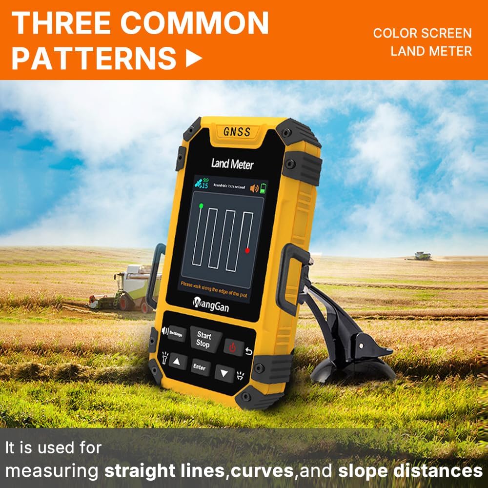


High-Accuracy GNSS Land Measurement: This handheld GPS for surveying delivers professional-grade precision with ±1% error for large areas (2,000+ sqm) and ±2m positioning accuracy (HDOP <1.0). Perfect for land surveyors, farmers, and outdoor enthusiasts, it supports six-star satellite positioning (GNSS/GPS) and multiple modes: Normal, Mountain, Fixed-Width, and Intelligent Slope Measurement. A must-have land surveying tool for property mapping, agriculture, and hiking navigation.
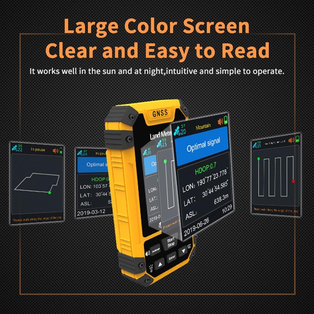
Real-Time Graphics & Smart Data Management: Instantly visualize land boundaries with live measurement graphics—no guesswork! Store 200+ area/distance records and export data via USB. Ideal for GPS land surveying, this handheld volume measuring instrument ensures efficiency for construction crews, foresters, and geocachers. Never lose critical land meter measurements again!
Auto Slope & Mountain Compensation: Skip manual calculations! This GNSS GPS device features Intelligent Slope and Mountain Modes to auto-adjust measurements on rugged terrain. Whether you’re mapping hillsides, farms, or trails, it eliminates errors—making it the most reliable surveying GPS for uneven landscapes.
Ultra-Durable & Portable Design: Built for fieldwork with IP65 waterproof/dustproof protection and a 18-hour battery life. At just 112g, this compact handheld GPS unit fits in any pocket. The bright yellow casing ensures visibility in low light, while the barometer, altimeter, and flashlight add utility for hiking GPS adventures or remote land surveys.
All-in-One Surveying Solution: Beyond land area measurement, use it for distance tracking (slope/fixed-point), machine load calculations, and boundary marking. Combines GPS surveying equipment precision with user-friendly features like data export and real-time updates. The ultimate handheld GNSS land meter for professionals and outdoor explorers!
User Reviews
Be the first to review “Heltec Handheld GPS Land Meter, High Accuracy GNSS Surveying Equipment for Land Measurement & Hiking 6 Satellite System Positioning IP65 Waterproof 18H Battery Slope/Mountain Mode Real-Time Graphics”
$139.00
There are no reviews yet.